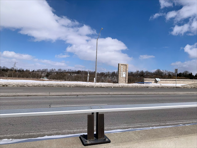
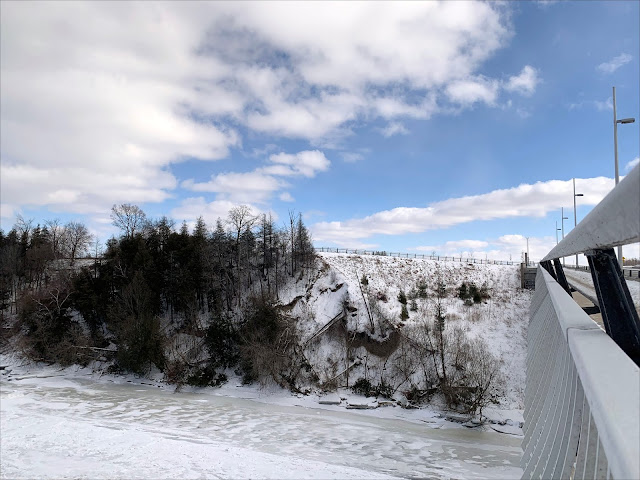
It always tempts me to go for a walk when I see the pure white clouds against a spectacularly blue sky. Someone told me that they find the colours of winter very depressing. To me, they are just a good as in the summer, just not the same shades. And when one has evergreens, white snow, and blue, cloudy skies, all the rest just adds to the scenery.
The bus let me off at Old Zellar Drive and Fairway Road and I crossed at the traffic circle to be on the side of the road where I wanted to capture photos from. This was my first shot and it was sometimes difficult to capture a shot with sunshine and clouds too, but this is an open area at this point that gives one a feeling of openness and freshness, even though there is a city immediately behind me.
This is where Woolner Trail leads one down to the Grand River. I debated which way I would approach the bridge, and this time I decided to take the sidewalk along Fairway Road North.
The sidewalk looked cleared and was not difficult to navigate with my walker. The snow was already dirty from traffic and clearing, but I was glad I went out as it was a great day with all the pouffy clouds.
I took a few large steps toward the bridge, sat on my walker and took a couple more photos.
Here I was about 0.5 miles from the bridge, which can bee seen left of centre of the trees.
As was mentioned earlier, the city was literally behind me. This is the view on the left as one approaches the Grand River Bridge on Fairway Road North.
It is my prayer that they don't fill up this field with housing like the ones in the above picture.
I had noticed this house in the trees, and also the barns. When I was on Woolner Trail last summer I debated about going into that location further, but was deterred by the fact that they have log fencing and also a no trespassing warning on the gate.
Here are the barns as seen through the trees.
I'm getting a bit closer to the bridge, but it still seems a long way off.
The house is seen a little clearer in this shot.
When the sun went behind the clouds the wind seemed to pick up and as I was out in an open area, I felt it and hesitated about how far I was going to go.
From here to the point where I turned around, is an elevated grade, so I stopped a few times to sit and catch my breath.
This is a zoomed view of the south side of the bridge just before I came around the bend in Fairway Road.
This shot is a normal one of the bridge from the same spot as the previous one.
More of the open field captured with the clouds floating above.
Another zoomed shot of the bridge.
As I approached the trails that lead down closer to the river I kept wondering if I would be able to travel back that way to catch the bus.
It was snow-covered and also deep enough that I was not going to attempt to walk it with my walker. The river is in the distance, but there is a pond here in the foreground. There is also a jet trail in the centre of the clouds.
This is what I could see across Fairway Road as I approached the bridge.
There was even snow where I would have liked to go to capture pictures similar, but with a flavour of winter, to what I had taken last summer.
Looking across the bridge toward the river on the North side.
Although there was snow, I used the railing along the bridge to get closer to the edge and take snapshots of the area below.
From what I could make out, the trail along the bottom here is open and if I had taken the trail from Woolner Trail I would have been able to navigate it. {Next Time!!!}
Looking up the bridge toward Riverbank Drive.
Peeking through railing of the bridge to capture different angles of the scenery below. My first spot along the south side of the bridge.
Another angle taken from that same spot.
I walked a distance up the bridge and again took photos through the railing. I really like this shot of the river.
From here you can see the farm buildings that I captured a shot of through the trees about half a mile back.
You can see that the ice has broken up at one point and has gathered down here in chunks.
The chunks fo ice are not quite as visible here, but the river is noticeable quite a distance down river.
Looking up the bridge and starting to feel the cold breezes as it is really exposed here.
Now I was able to get a shot of the river, including the ice chunks on the right, but the sun had gone behind some clouds so it is not as bright as it had been just a minute before.
This is a shot toward the far bank where Riverbank Road travels just the other side of the river.
Looking back toward the city from this vantage point.
A close shot of the River Bank.
Looking down the river. It is frozen but I would not want to venture onto the ice.
To the right, top, centre are the farm buildings from this side of the property.
I've made it to the top of the bridge and stepped into the snow to capture this shot of the river and buildings just the other side of Fairway Road North.
This is a zoomed in shot of the same view.
I don't know if you can see it, but there is a dark plume of smoke rising from a smoke stack that I believe is on the other side of the river.
I love the stonework of the bridge and approaches to it. It gives the bridge a bit of a rustic look, even though there is no iron, or steel siding, it is beautiful in my eyes at least. The only thing I wish was that they had cleared the snow in these areas so I could get more vantage points of photos. Guess I'll have to wait for a few days or weeks for that to happen.
Now I have crossed Fairway Road North to the North side and am looking toward the Waterloo Wellington Flight Centre, and capturing the farm between me and it.
Looking toward the river and the hill that is at the top of the bank. It looks like someone had corn in the field here last year.
Looking down the bridge toward the city.
There is a paved trail up along that fence in the second last photo, but again the trail was not cleared so I was not able to get photos at this time of the year to compare with last summer's shots. And I don't have a shovel that I could have brought with me to clear it to get there anyway.
The snow-covered path on the right and the stonework along the edge where there is a steep bank leading down to the river.
Just one single path cleared on the bridge. A snowblower would have made such a difference.
You can see how steep it is here and why they put up the stonework to protect people from getting hurt. The scene is beautiful, no matter what time of the year and worth looking through the rails of the bridge to see.
I'm wishing I had been able to take that trail along that fence at the top to get an elevated view of the river and bridge from there.
A view of a portion of the bridge and the river, with the smoking chimney in the distance.
Another got view of the river to the north of the bridge.
Another view of the small evergreens along the rise of the bank on the east side of the river.
I can still see the bend in the river and trees that have fallen along the right side here.
Another view of the river.
My one last view up the river.
Down below is the trail I could have travelled if I had been able to traverse through the snow on the trail off to the left. I took that very trail last summer and continued along it for a couple of miles before going home.
One last look at the river before I head back to the traffic circle to catch a bus home.
As I was walking along toward the traffic circle, I somehow dislodged my basket on my walker and a kind driver who saw it, picked it up and returned it to me. I'm so thankful that he was honest enough to do so. I got home safe and sound after catching the bus just as it arrived at the stop where I would have had to wait another half an hour. All in all I put on over 5200 steps in yesterday's walking.


